Skip to content
County Kerry — photo by Graham Horn
Ireland › Counties › Kerry

County Kerry

Ciarraí

Munster · 759 places · 159 photos · 11 videos

Hero photo: Graham Horn · CC BY-SA 2.0

About County Kerry

County Kerry (Irish: Contae Chiarraí) is a county on the southwest coast of Ireland, within the province of Munster and the Southern Region. It is bordered by two other counties; Limerick to the east, and Cork to the south and east. It is separated from Clare to the north by the Shannon Estuary. With an area of 4,807 square kilometres (1,856 sq mi) and a population of 156,458 as of 2022, it is the 5th largest of Ireland's 32 counties by land area, and the 15th most populous. The governing local authority is Kerry County Council. Bounded by the Atlantic Ocean, Kerry is Ireland's most westerly county. Its rugged coastline stretches for 886 kilometres (551 miles) and is characterised by bays, sea cliffs, beaches and many small offshore islands, of which the Blaskets and the Skelligs are the most notable. The county's peninsulas have a hilly to mountainous topography, with the MacGillycuddy's Reeks on Iveragh rising to over 1,000 m (3,300 ft). By contrast, its interior regions are mostly flat, interspersed with low mountain ranges such as the Stacks and the Mullaghareirks. The climate of Kerry is dominated by the North Atlantic Current and is usually mild and humid, with abundant precipitation. This allows for the growth of a wide variety of temperate and sub-tropical plants not typically found at such northerly latitudes. The county is named after the Cíarraige people, who were the region's dominant pre-historic sept. County Kerry first appeared as a separate shire in 1232, and was at that time part of a royal grant given to the Earls of Desmond. The present-day county was divided for centuries between the Gaelic Kingdom of Desmond, ruled by the Mac Cárthaigh dynasty, and the Anglo-Norman Earldom of Desmond, ruled by the Geraldines. These two regions were merged in 1606 in the aftermath of the Nine Years' War. Kerry has two official Gaeltacht regions, Gaeltacht Uíbh Ráthaigh on the Iveragh Peninsula and Gaeltacht Corca Dhuibhne on the Dingle Peninsula, the latter of which is the only Gaeltacht in Munster where Irish is the daily spoken language of the majority of the population. In the county as a whole, 40.2 percent of residents were able to speak Irish as of 2022. The regional dialect is Munster Irish, exemplified by the influential works of Blasket Islanders such as Peig Sayers, Muiris Ó Súilleabháin and Tomás Ó Criomhthain.

Intro from Wikipedia (CC BY-SA 4.0)

Explore Kerry by category

Top 10 must-sees in Kerry

View list page →
Carrauntoohil — photo by Enter #1

Carrauntoohil

Carrauntoohil, Carrauntoohill or Carrantuohill (, KARR-ən-TOO-əl; Irish: Corrán Tuathail [ˌkɔɾˠaːn̪ˠ ˈt̪ˠuəhəlʲ], meaning "Tuathal's sickle") is the highest mountain in Ireland at 1,038.6 metres (3,407 feet 6 inches). It is on the Iveragh Peninsula in County Kerry, close to the centre of Ireland's highest mountain range, MacGillycuddy's Reeks. Carrauntoohil is composed mainly of sandstone, whose glaciation produced distinctive features on the mountain such as the Eagle's Nest corrie and some deep gullies and sharp arêtes in its east and northeastern faces that are popular with rock and winter climbers. As Ireland's highest mountain, Carrauntoohil is popular with mountain walkers, who most commonly ascend via the Devil's Ladder route; however, Carrauntoohil is also climbed as part of longer mountain walking routes in the MacGillycuddy's Reeks range, including the 15-kilometre (9+1⁄2 mi) Coomloughra Horseshoe or the 26-kilometre (16 mi) MacGillycuddy's Reeks Ridge Walk of the entire mountain range. Carrauntoohil, and most of the range is held in private ownership and is not part of any Irish national park; however, reasonable access is granted to the public for recreational use.

Popularity
93
Explore place →
Cnoc Bréanainn — photo by Colin Park #2

Cnoc Bréanainn

Mount Brandon or Brandon (Irish: Cnoc Bréanainn, meaning 'Brendan's hill'), at 952 metres (3,123 ft), is one of the ten highest peaks in Ireland, being the 8th–highest peak in Ireland on the Arderin list, and the 9th–highest on the Vandeleur-Lynam list. Brandon is the highest Irish mountain outside the MacGillycuddy's Reeks range and has the greatest prominence of any Irish peak except Carrauntoohil, Ireland's highest mountain. Mount Brandon is at the centre of a long high ridge called the Brandon Group range of mountains in the Dingle Peninsula in County Kerry. The ridge contains seven other major peaks (i.e. above 2,000 ft in height); one is the similarly named Brandon Peak (840 metres). The positioning and dimensions of the Brandon Group ridge have made it the scene of several air accidents over the years. The mountain, and range, is named after Saint Brendan, and is the end of a Christian pilgrimage trail known as Cosán na Naomh. It is also well regarded for hill walking with routes such as the 4–5-hour Faha Route (also called The Pilgrim's Path), and the 6–7-hour traverse of the entire range known as "one of the finest ridgewalks in Ireland".

Popularity
66
Explore place →
Torc Mountain — photo by TJBrosnan at English Wikipedia #3

Torc Mountain

Torc Mountain (Irish: Sliabh Torc, meaning 'mountain of wild boar'), at 535 metres (1,755 ft), is the 329th–highest peak in Ireland on the Arderin list. It is a popular mountain for hill walkers as it has a stone or boarded path (using railway sleepers) from its base at Torc Waterfall to its summit, which has views of the Lakes of Killarney. Torc Mountain is part of the Mangerton Mountain Group range in County Kerry, Ireland.

Popularity
48
Explore place →
Purple Mountain — photo by mozzercork from Republic of Ireland #4

Purple Mountain

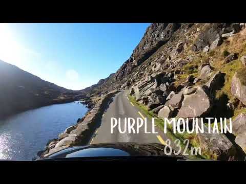
Purple Mountain (Irish: an Sliabh Corcra) at 832 metres (2,730 ft) high, is the 21st–highest peak in Ireland on the Arderin scale, and the 28th–highest according to the Vandeleur-Lynam scale. It is located in County Kerry, and is the highest point of the Purple Mountain Group.

Popularity
46
Explore place →
Rossbeigh Beach — photo by Goatoo #6

Rossbeigh Beach

Rossbeigh, or Rossbehy (Irish: Ros Beithe, meaning 'headland of the birch trees'), is a sandspit with beaches on either side, located approximately 1.6 km from the village of Glenbeigh, in County Kerry, Ireland. It is on the Ring of Kerry, on the Dingle Bay side of the Iveragh Peninsula. Rossbeigh contains a large volume of sand dunes and herbaceous vegetation. It is considered an important habitat for flora and fauna, including wildfowl (salmon and clam are locally farmed). The beach is on the Wild Atlantic Way tourist route.

Popularity
42
Explore place →
Inch Beach — photo by Draceane #8

Inch Beach

Inch (Irish: Inse, meaning 'river meadow') is a small coastal settlement and townland on the Dingle Peninsula in County Kerry, Ireland. Inch Strand, in Inch townland, is on a long sand spit and dune system which reaches into Dingle Bay. The R561 regional road passes through the area. Evidence of ancient settlement in the area includes a number of midden, ringfort and ecclesiastical enclosure sites in Inch and Inch East townlands. The graveyard enclosure, in Inch East, contains a ruined single-cell church which dates to at least the 13th century. Inch Strand, also known as Inch Beach, is a spit which is 5 km in length and, together with its dune system, forms part of the Special Area of Conservation at Castlemaine Harbour.

Popularity
39
Explore place →
Derrynane Abbey — photo by Mike Searle #9

Derrynane Abbey

Derrynane Abbey also known as Ahamore Abbey (Irish: Mainistir Achaidh Mhóir) is a ruined abbey in Derrynane in County Kerry, Ireland. It is located near the town of Caherdaniel and is very close to Derrynane House, the house of Daniel O'Connell. The abbey is on an island appropriately named Abbey Island. It is accessible from the mainland through a beach. It is believed to have been built in the 6th century.

Popularity
38
Explore place →

Videos from Kerry

Carrauntoohil | Ireland's Highest Peak | Devil's Ladder & Zigzags | Drone footage from the peak

Carrauntoohil | Ireland's Highest Peak | Devil's Ladder & Zigzags | Drone footage from the peak

Flynn Hikes

Carrauntoohil →
View from just below summit of  Cnoc Bréanainn,Mount Brandon,Dingle peninsula Kerry  Sept 1 2022

View from just below summit of Cnoc Bréanainn,Mount Brandon,Dingle peninsula Kerry Sept 1 2022

iamearthbornami

Cnoc Bréanainn →
Torc Mountain Hike, Killarney, Ireland (4K)

Torc Mountain Hike, Killarney, Ireland (4K)

Exploring Europe

Torc Mountain →
HIKING PURPLE MOUNTAIN, KILLARNEY | A DAY ON THE MOUNTAIN

HIKING PURPLE MOUNTAIN, KILLARNEY | A DAY ON THE MOUNTAIN

David Moynihan

Purple Mountain →
Geokaun Mountain and Cliffs | Fogher Cliffs in the Ring of Kerry, Ireland

Geokaun Mountain and Cliffs | Fogher Cliffs in the Ring of Kerry, Ireland

Nidhi Upadhyay - Living in the Dream

Geokaun →
Rossbeigh Beach - Kerry - Ireland

Rossbeigh Beach - Kerry - Ireland

Jack O'Shea

Rossbeigh Beach →

All places in Kerry

Showing 24 of 759 places

Carrauntoohil — photo by Enter▶ Video
PeakKerry

Carrauntoohil

Carrauntoohil, Carrauntoohill or Carrantuohill (, KARR-ən-TOO-əl; Irish: Corrán Tuathail [ˌkɔɾˠaːn̪ˠ ˈt̪ˠuəhəlʲ], meaning "Tuathal's sickle") is the highest mountain in Ireland at 1,038.6 metres (3,407 feet 6 inches). It is on the Iveragh Peninsula in County Kerry, close to the centre of Ireland's highest mountain range, MacGillycuddy's Reeks. Carrauntoohil is composed mainly of sandstone, whose glaciation produced distinctive features on the mountain such as the Eagle's Nest corrie and some deep gullies and sharp arêtes in its east and northeastern faces that are popular with rock and winter climbers. As Ireland's highest mountain, Carrauntoohil is popular with mountain walkers, who most commonly ascend via the Devil's Ladder route; however, Carrauntoohil is also climbed as part of longer mountain walking routes in the MacGillycuddy's Reeks range, including the 15-kilometre (9+1⁄2 mi) Coomloughra Horseshoe or the 26-kilometre (16 mi) MacGillycuddy's Reeks Ridge Walk of the entire mountain range. Carrauntoohil, and most of the range is held in private ownership and is not part of any Irish national park; however, reasonable access is granted to the public for recreational use.

Cnoc Bréanainn — photo by Colin Park▶ Video
PeakKerry

Cnoc Bréanainn

Mount Brandon or Brandon (Irish: Cnoc Bréanainn, meaning 'Brendan's hill'), at 952 metres (3,123 ft), is one of the ten highest peaks in Ireland, being the 8th–highest peak in Ireland on the Arderin list, and the 9th–highest on the Vandeleur-Lynam list. Brandon is the highest Irish mountain outside the MacGillycuddy's Reeks range and has the greatest prominence of any Irish peak except Carrauntoohil, Ireland's highest mountain. Mount Brandon is at the centre of a long high ridge called the Brandon Group range of mountains in the Dingle Peninsula in County Kerry. The ridge contains seven other major peaks (i.e. above 2,000 ft in height); one is the similarly named Brandon Peak (840 metres). The positioning and dimensions of the Brandon Group ridge have made it the scene of several air accidents over the years. The mountain, and range, is named after Saint Brendan, and is the end of a Christian pilgrimage trail known as Cosán na Naomh. It is also well regarded for hill walking with routes such as the 4–5-hour Faha Route (also called The Pilgrim's Path), and the 6–7-hour traverse of the entire range known as "one of the finest ridgewalks in Ireland".

Torc Mountain — photo by TJBrosnan at English Wikipedia▶ Video
ViewpointKerry

Torc Mountain

Torc Mountain (Irish: Sliabh Torc, meaning 'mountain of wild boar'), at 535 metres (1,755 ft), is the 329th–highest peak in Ireland on the Arderin list. It is a popular mountain for hill walkers as it has a stone or boarded path (using railway sleepers) from its base at Torc Waterfall to its summit, which has views of the Lakes of Killarney. Torc Mountain is part of the Mangerton Mountain Group range in County Kerry, Ireland.

Purple Mountain — photo by mozzercork from Republic of Ireland▶ Video
PeakKerry

Purple Mountain

Purple Mountain (Irish: an Sliabh Corcra) at 832 metres (2,730 ft) high, is the 21st–highest peak in Ireland on the Arderin scale, and the 28th–highest according to the Vandeleur-Lynam scale. It is located in County Kerry, and is the highest point of the Purple Mountain Group.

Geokaun — photo by Jonathan Billinger▶ Video
PeakKerry

Geokaun

Geokaun Mountain (Irish: an Geocán) is the highest mountain on Valentia Island, County Kerry.

Rossbeigh Beach — photo by Goatoo▶ Video
BeachKerry

Rossbeigh Beach

Rossbeigh, or Rossbehy (Irish: Ros Beithe, meaning 'headland of the birch trees'), is a sandspit with beaches on either side, located approximately 1.6 km from the village of Glenbeigh, in County Kerry, Ireland. It is on the Ring of Kerry, on the Dingle Bay side of the Iveragh Peninsula. Rossbeigh contains a large volume of sand dunes and herbaceous vegetation. It is considered an important habitat for flora and fauna, including wildfowl (salmon and clam are locally farmed). The beach is on the Wild Atlantic Way tourist route.

Inch Beach — photo by Draceane▶ Video
BeachKerry

Inch Beach

Inch (Irish: Inse, meaning 'river meadow') is a small coastal settlement and townland on the Dingle Peninsula in County Kerry, Ireland. Inch Strand, in Inch townland, is on a long sand spit and dune system which reaches into Dingle Bay. The R561 regional road passes through the area. Evidence of ancient settlement in the area includes a number of midden, ringfort and ecclesiastical enclosure sites in Inch and Inch East townlands. The graveyard enclosure, in Inch East, contains a ruined single-cell church which dates to at least the 13th century. Inch Strand, also known as Inch Beach, is a spit which is 5 km in length and, together with its dune system, forms part of the Special Area of Conservation at Castlemaine Harbour.

Derrynane Abbey — photo by Mike Searle
AbbeyKerry

Derrynane Abbey

Derrynane Abbey also known as Ahamore Abbey (Irish: Mainistir Achaidh Mhóir) is a ruined abbey in Derrynane in County Kerry, Ireland. It is located near the town of Caherdaniel and is very close to Derrynane House, the house of Daniel O'Connell. The abbey is on an island appropriately named Abbey Island. It is accessible from the mainland through a beach. It is believed to have been built in the 6th century.

Binn os Gaoith — photo by Peter Craine
PeakKerry

Binn os Gaoith

Beenoskee or Benoskee (Irish: Binn os Gaoith) is a mountain on the Dingle Peninsula in County Kerry, Ireland. It rises to 826 m (2,710 ft) and is the highest of the 'Central Dingle' Mountains.

Cruach Mhór — photo by Britishfinance
PeakKerry

Cruach Mhór

Cruach Mhór (Irish for "big stack"), at 932 metres (3,058 ft) high, is the tenth-highest peak in Ireland on the Arderin list, and the eleventh-highest peak in Ireland according to the Vandeleur-Lynam list. A distinctive square grotto marks the summit. It is part of the MacGillycuddy's Reeks in County Kerry.

Skellig Monastery — photo by Jerzy Strzelecki
AbbeyKerry

Skellig Monastery

Skellig Michael (Irish: Sceilig Mhichíl [ˌʃcɛlʲəɟ ˈvʲɪçiːlʲ]), also called Great Skellig (Irish: Sceilig Mhór [ˈʃcɛlʲəɟ woːɾˠ]), is a twin-pinnacled crag 11.6 kilometres (7.2 mi) west of the Iveragh Peninsula in County Kerry, Ireland. The island is named after the archangel Michael; while "Skellig" is derived from the Irish language word sceilig, meaning a splinter of stone. Its twin island, Little Skellig (Sceilig Bheag), is smaller and inaccessible. The two islands were formed c. 374–360 million years ago during a period of mountain formation, along with the local MacGillycuddy's Reeks mountain range. Rising water levels later separated them from the mainland. Skellig Michael consists of approximately 22 hectares (54 acres) of rock, with its highest point, known as the Spit, 218 m (714 ft) above sea level. Defined by twin peaks and a central valley called Christ’s Saddle, the island has a steep and inhospitable landscape. It is best known for its Gaelic monastery, founded between the 6th and 8th centuries, and its variety of inhabiting species, which include gannets, puffins, a colony of razorbills and a population of approximately fifty grey seals. The island is of special interest to archaeologists, as the monastic settlement is in unusually good condition. The monastery on the northern peak is situated at an elevation of 170 to 180 m (550 to 600 ft), Christ's Saddle at 129 m (422 ft), and the flagstaff area are 37 m (120 ft) above sea level. The monastery can be approached by narrow and steep flights of stone steps which ascend from three landing points. The hermitage on the south peak is only accessible via a dangerous approach and is largely closed to the public. Because of the often difficult crossing from the mainland and the exposed nature of the landing spots, the island is accessible only during the summer months. UNESCO designated Skellig Michael a World Heritage Site in 1996.

Ballyheigue Castle — photo by No machine-readable author provided. Kglavin~commonswiki assumed (based on copyright claims).
CastleKerry

Ballyheigue Castle

Ballyheigue Castle, in Ballyheigue, County Kerry, is a ruined Tudor-gothic-revival-style mansion. It was used as a residence of the Crosbie family (including the Bishop of Ardfert and Aghadoe, High Sheriffs of Kerry and members of the UK Parliament) and later as a jail. It has been burned twice. It is currently part of a golf course.

Crag Cave — photo by Wikimedia Commons contributor
CaveKerry

Crag Cave

Crag Cave is a cave in Ireland, located just outside Castleisland, County Kerry. Formed in elevated limestone rock, the system extends to 3.8 kilometres (2.4 mi) of surveyed passage, on two levels. It is the 7th-longest cave system in the Republic of Ireland, and the 10th-longest in the whole of Ireland.

Kerry Bog Village — photo by Robert Linsdell from St. Andrews, Canada
GeneralKerry

Kerry Bog Village

The Kerry Bog Village is an open-air museum situated in west County Kerry focused on the history of Ireland and culture. It is a popular tourist stop along the Ring of Kerry, between the towns of Killorglin and Glenbeigh. The outdoor museum recreates traditional Irish thatched cottages and the lives of their inhabitants during the 19th century. The museum founder also played a role in reviving the Kerry Bog Pony as a viable breed. The village's operators describe it as the “only one of its kind in Europe,” referring to its unique combination of restored 19th-century thatched cottages, traditional rural artifacts, and efforts to revive the Kerry Bog Pony breed.

Kerry County Museum — photo by Wikimedia Commons contributor
MuseumKerry

Kerry County Museum

Kerry County Museum (Irish: Príomh-Mhúsaem Chiarraí) is a museum located in Tralee, County Kerry, Ireland. The museum is based in the Ashe Memorial Hall on Denny Street in the centre of Tralee, which had been completed in 1928 as the headquarters of both Kerry County Council and Tralee Urban District Council. After the two councils vacated the building in the 1980s, it was converted to become the County Museum, opening in 1992. The aim of the museum is to collect, record, preserve and display the material heritage of County Kerry.

Killarney National Park — photo by Wikimedia Commons contributor
National ParkKerry

Killarney National Park

Killarney National Park (Irish: Páirc Náisiúnta Chill Airne), near the town of Killarney, County Kerry, was the first national park in Ireland, created when the Muckross Estate was donated to the Irish Free State in 1932. The park has since been substantially expanded and encompasses over 102.89 km2 (25,425 acres) of diverse ecology, including the Lakes of Killarney, oak and yew woodlands of international importance, and mountain peaks. It has the only red deer herd on mainland Ireland and the most extensive covering of native forest remaining in Ireland. The park is of high ecological value because of the quality, diversity, and extensiveness of many of its habitats and the wide variety of species that they accommodate, some of which are rare. The park was designated a UNESCO Biosphere Reserve in 1981. The park forms part of a Special Area of Conservation and a Special Protection Area. The National Parks and Wildlife Service is responsible for the management and administration of the park. Nature conservation is the main objective of the park, and ecosystems in their natural state are highly valued. The park is known for its scenery, and recreation and tourism amenities are provided for.

Bentee — photo by Linda Bailey
PeakKerry

Bentee

Bentee or Benatee (from Irish Binn an Tí, meaning 'peak of the house') is a hill overlooking the town of Cahersiveen in County Kerry, Ireland.

Caher West Top — photo by Colin Park
PeakKerry

Caher West Top

Caher West Top (Irish: Cathair na Féinne, meaning 'stone fort of the Fianna') at 973.4 metres (3,193 ft 7 in), is the fifth-highest peak in Ireland on the Irish Vandeleur-Lynam classification, and part of the MacGillycuddy's Reeks range. Caher West Top is the only Furth to have a prominence below 30 metres (98 ft).

Cnoc na Toinne — photo by Nigel Cox
PeakKerry

Cnoc na Toinne

Cnoc na Toinne (Irish for "hill of the wave"), at 845 metres (2,772 ft), is the 17th-highest peak in Ireland on the Arderin list, and the 23rd-highest peak in Ireland on the Vandeleur-Lynam list. It is part of the MacGillycuddy's Reeks range in County Kerry. Cnoc na Toinne lies between the Coomloughra Reeks and the Eastern Reeks, and is just above the col of the Devil's Ladder, a popular route for climbing Carrauntoohil, Ireland's highest mountain.

Hag's Tooth — photo by Graham Horn
PeakKerry

Hag's Tooth

The Hag's Tooth (Irish: Stumpa an tSaimh, meaning 'stump of the sorrel'), at 650 metres (2,130 ft) high, is a sharp rock spike which is the 193rd highest peak in Ireland on the Vandeleur-Lynam scale. It is also known as Stumpeenadaff (Irish: Stuimpín an Daimh, meaning 'little pinnacle of the ox'). The Hag's Tooth is situated in the Hag's Glen beside the Eagle's Nest corrie of Carrauntoohil and is part of the MacGillycuddy's Reeks in County Kerry.

Cnoc na Ceathrún — photo by Pampuco
PeakKerry

Cnoc na Ceathrún

Carhoo Hill or Ballymacadoyle Hill (Irish: Cnoc na Ceathrún, meaning 'Hill of the quarter') is a large hill south-west of Dingle in County Kerry, Ireland.

Beenkeragh — photo by Nigel Cox
PeakKerry

Beenkeragh

Beenkeragh or Benkeeragh (Irish: Binn Chaorach, meaning 'sheep mountain') is the second-highest peak in Ireland, at 1,008.2 metres (3,308 ft). It is part of the MacGillycuddy's Reeks range in County Kerry. Beenkeragh also gives its name the infamous Beenkeragh Ridge, the narrow rocky arete between Beenkeragh and Carrauntoohil, Ireland's highest mountain.

Caher — photo by Colin Park
PeakKerry

Caher

Caher or Caher East Top (Irish: Cathair na Féinne, meaning 'stone fort of the Fianna') at 1,000 metres (3,300 ft), is the third-highest peak in Ireland, on the Irish Arderin and Vandeleur-Lynam classifications. It is part of the MacGillycuddy's Reeks in County Kerry.

More counties in Munster